Draw parcel candidates from the satellite photo, automatically.
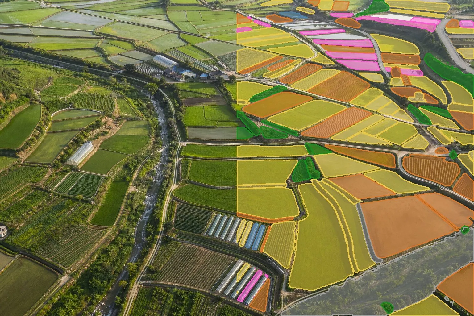
SAM2 splits the satellite photo of the same spot into parcel candidates drawn as gold polygons; hover a cell to see its area in hectares.
Method
Take the boundary work off your plate first.
To look at damage field by field you first need boundaries. TERRASENSE uses the image segmentation model SAM2 (Segment Anything Model 2) to split the satellite photo into parcel candidates, which guide you as you click a boundary on the map and register the field.
- Parcel candidates from SAM2
- Gold polygons with area (ha)
- Shares the yearly quota with growth screening
- The first run can take longer while the model loads
Limits
A candidate is a candidate.
Candidates come from the photo and can differ from real boundaries. We are clear about where they can and cannot be used.
Not an official boundary
Not a cadastral map, farmland register or official boundary, and not for land-use or direct-payment reviews.
May split or merge
Roads, water or shadows can split one parcel or merge it with a neighbour.
A person registers
Users click the boundary to register a field. Registered fields feed growth screening and disaster analysis.
Specification
Data, method and outputs
| Item | Detail |
|---|---|
| Model | SAM2 (Segment Anything Model 2) |
| Input | Satellite photo of the same spot |
| Output | Parcel candidate polygons, area (ha) |
| Quota | Shared with growth screening |
| Not for | Cadastre, farmland register, land-use or direct-payment reviews |
TERRASENSE is a satellite first screening of suspected damage. It does not replace the crop-insurance loss assessment: the loss rate and indemnity are confirmed by a certified loss assessor in the field.
FAQ
Frequently asked questions
Can candidates be used as official boundaries?
No. They are not a cadastral map, register or official boundary. They help group damage by field.
Which AI model is used?
SAM2 (Segment Anything Model 2), an image segmentation model.
Are greenhouses and orchards split out?
If their shapes are distinct in the photo they become candidates, but shadows and roads can split or merge them, so check before registering.
Related pages
Work with us
See your county’s fields from orbit, before the next storm.
We start with a satellite screening of your area from public data, then compare the results with your own field survey records. No equipment goes in the field.