A satellite + vision-AI platform for crop loss assessment.
TERRASENSE handles a disaster from start to finish in three stages: satellite wide-area analysis, vision-AI field survey and the loss report. It runs in a web browser with nothing installed in the field.
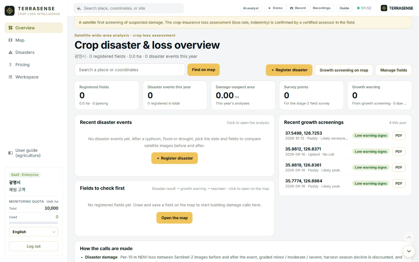
One screen
Fields, disasters and survey points in one place.
The overview shows registered fields, disaster events this year, damage-suspect area, survey points and growth warnings. Each number opens the map or the disaster analysis.
- Register a disaster → before/after satellite comparison
- Growth screening and field boundaries on the map
- Field management, history and reports
- AI analyst and a guided Demo mode for presentations
- Interface in 17 languages
Features
Six features
Watch growth on ordinary days, find damage when disaster strikes, and pass it on to the survey and the report.
Disaster damage analysis
Sentinel-2 before/after, minor / moderate / severe per 10 m.
Radar flood detection
Flooded cells with Sentinel-1, through cloud.
Growth screening
NDVI, NDMI, growth stage, degree-days.
Field boundary detection
Parcel candidates and area with SAM2.
Field survey points
3 damage + 1 control, CSV and GeoJSON.
Loss-assessment report
Map, area and points as a draft PDF.
Data
Built on free public satellites and open data.
Data costs almost nothing, so wide areas can be watched often.
| Data | Used for | Notes |
|---|---|---|
| Sentinel-2 L2A | Growth screening, before/after NDVI and NDMI | Optical, 10 m, revisits about every 5 days, blocked by cloud |
| Sentinel-1 VV | Flood detection after rain and typhoons | Radar, independent of cloud and night |
| SCL mask | Dropping cloud and shadow cells | Sentinel-2 scene classification |
| Open-Meteo | Degree-days, rainfall, monthly growth curve | Open weather data |
| SAM2 | Field boundary detection (parcel candidates) | Image segmentation model |
| Esri World Imagery | Map background | Basemap (Maxar and others) |
TERRASENSE is a satellite first screening of suspected damage. It does not replace the crop-insurance loss assessment: the loss rate and indemnity are confirmed by a certified loss assessor in the field.
FAQ
Frequently asked questions
Which crops?
Paddy, upland and orchard. The crop is chosen by the user and sets the base temperature and expected growth curve.
How much area can we register?
The subscription covers up to 10,000 ha of monitoring area; the remaining area is shown on screen.
Which languages?
The interface switches between 17 languages, including Korean, English, Japanese, Chinese, Vietnamese, Thai and Indonesian.
Work with us
See your county’s fields from orbit, before the next storm.
We start with a satellite screening of your area from public data, then compare the results with your own field survey records. No equipment goes in the field.